The summers of our future
In the current heatwave, Europe resembles a desert
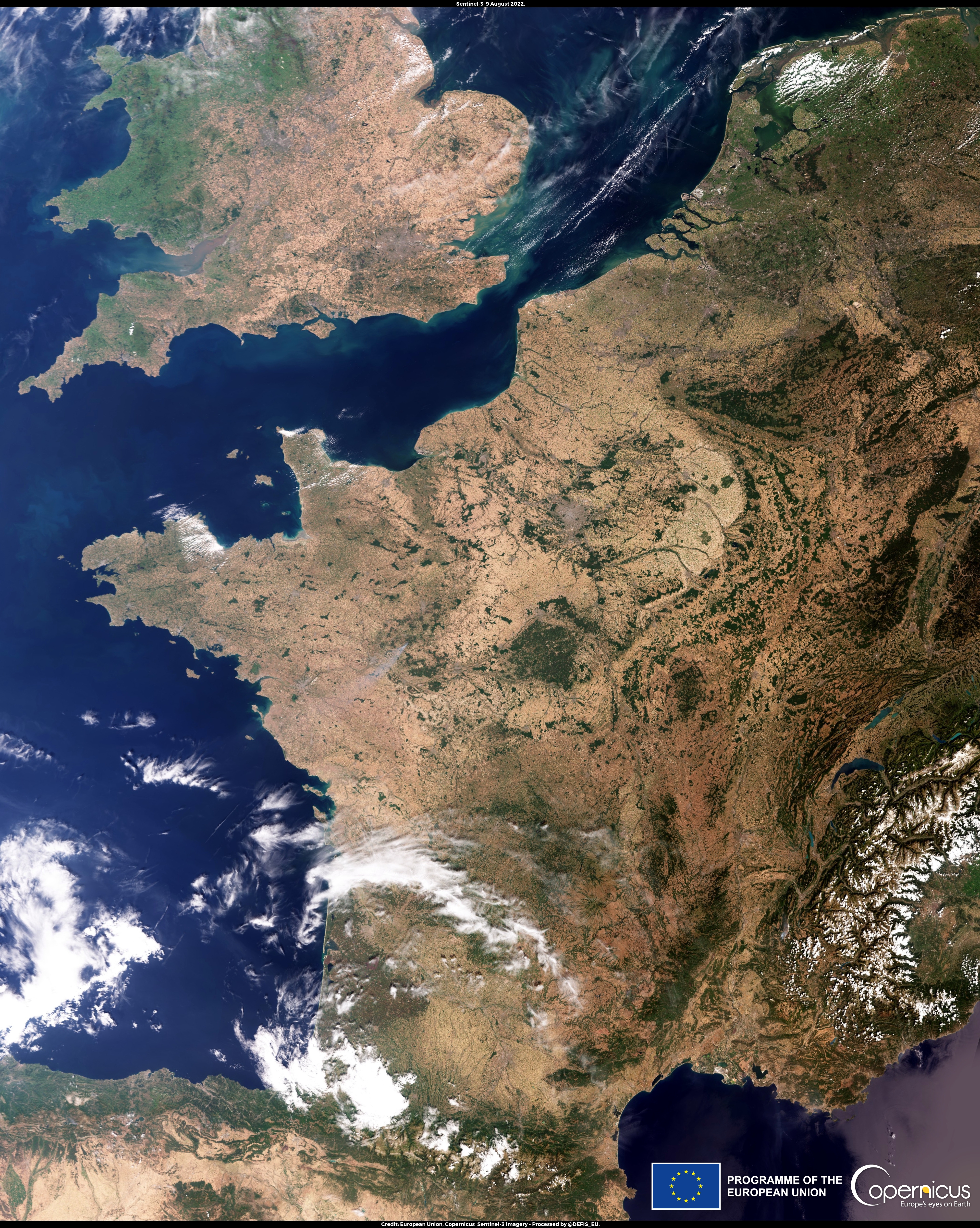
Image credit: European Union, Copernicus Sentinel-3
We are in the year 2022, but it feels like 2050.
I’ve lost track of which heatwave it is. In good weeks, the temperature drops below 20 degrees at night, in bad weeks it’s 25 degrees at night. Our apartment becomes a cave because we try to minimize the sun’s radiation - and yet it’s almost 29 degrees inside right now.
Recently, I saw a satellite image from Copernicus, the Earth observation program of the European Space Agency and the European Commission, that is as impressive as it is disturbing. It is the “Image of the Day” from August 11 and Copernicus writes about it:
A new heatwave, the fourth since the beginning of June 2022, is ongoing in central and western Europe.
According to the national weather services, air temperatures between 9 and 14 August could again exceed 44°C in Spain, 40°C in France, 35°C in the south of the United Kingdom and 30°C in the Netherlands.
What is striking about the picture is how large parts of France and the south of England are simply dried up. There are individual green spots, but large parts are brown and dry.
A satellite image from August 9, 2022 shows how large parts of France have dried up. Credit: European Union, Copernicus Sentinel-3 imagery
You can see Lake Geneva in the lower right corner of the picture, where I live. In the nearby Alps there is still some snow, but in the valley between the Alps and the Jura, where the lake is also located, the western shore is particularly dry. Of course, this is also noticeable in everyday life: the plants in the parks have been watered for weeks. In the morning, small lawn sprinklers are set up, which create small green islands in their catchment area - but the effect is only temporary and the areas dry out again quickly.
When I showed the satellite image to my girlfriend at the breakfast table, her first thought was that it looked like aerial photos of New Mexico. Except: there and in neighboring Arizona is the Chihuahuan Desert, which extends to Mexico. When you compare the satellite images, it is frightening how few differences there are between the two images from America and the south of the USA.
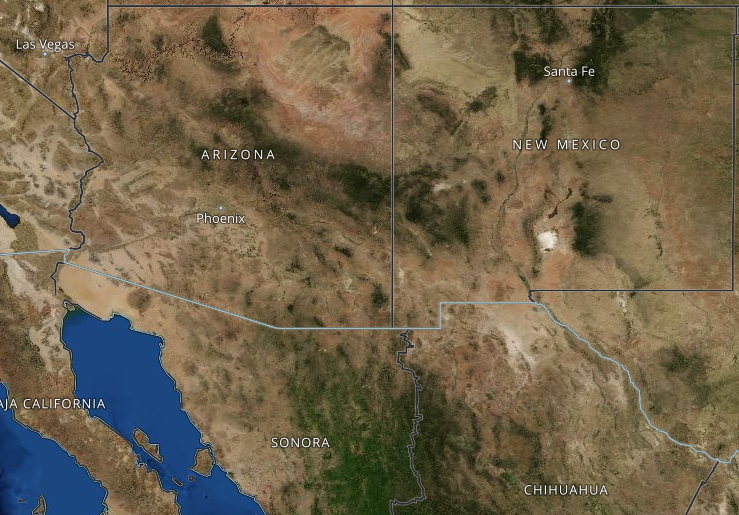 Satellite image of New Mexico, Arizona and northern Mexico Credit: NASA EarthData
For a few days now, there has been a picture of the Loire Valley on Twitter near Nantes, which is largely dried up and in which the Loire itself resembles a trickle. Are these the summers of our future?